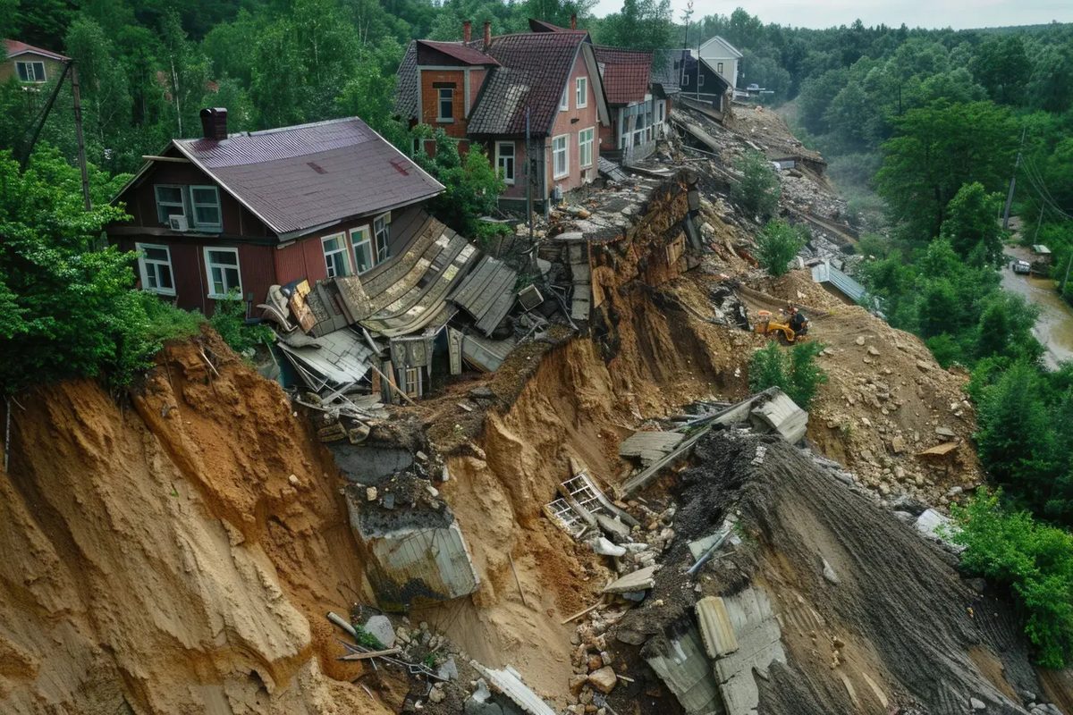
Climate change is not just an increase in temperature. It’s all about intensity. Heavy rains hit the mountain areas more often than ever before. This flood triggers a predictable, deadly consequence: landslides. The soil itself is becoming increasingly unreliable. Deforestation and aggressive agricultural practices destroy the vegetation that holds the soil in place and turn stable slopes into ticking time bombs.
We see the results in real time. Slopes are sliding. The infrastructure is crumbling. And people die.
This is not just an environmental statistic. This is a public safety crisis. When mudslides hit populated areas, the damage is measured in terms of human lives and not just property damage. In January 2024, the town of Gaopo in Yunnan, China learned this the hard way. The massive landslide buried nearly twenty houses under tons of mud and debris. The number of dead rose to over thirty. Families disappeared overnight.
Early detection of these events is no longer optional. It’s important.
But how do you detect something that moves with the weight of a mountain? Traditional methods are based on visual inspection or simple seismic sensors, which often do not provide sufficient lead time. Once you see the ground cracking, it’s usually too late to evacuate. The time window for alarms is often minutes, sometimes seconds.
We need better tools. We need to understand why slopes fail before they give way.
Why soil stability is more important than you think
The science behind landslides is deceptively simple. Gravity pulls downwards. Water pushes out. When the soil is saturated, the friction between the particles decreases. The slope loses its grip.
Agriculture makes this worse. Heavy machinery compacts the soil. Plowing disturbs the root system. Without deep roots to provide natural anchoring, topsoil will loosen. Add in climate-related extreme rainfall and you have a recipe for disaster.
The terrain in Yunnan is steep. Geology is complex. The rain was relentless. The result was catastrophic. But it doesn’t have to be that way.
If we can detect the precursors—subtle changes, microbreaks, water saturation—we can issue warnings. Early detection means evacuation. Evacuation means survival.
The Push for Real-Time Monitoring
Current technology is getting better. Satellite images can be used to monitor the earth’s movements in large areas. But satellites are not always in real time. Cloud cover blocks their view.
Ground-based sensors offer another solution. They measure tilt, vibration and moisture. When installed correctly, they can detect movement before complete collapse.
The challenge is the cost. And maintenance. Remote areas often lack the infrastructure to support these systems. Power supplies fail. The sensors are buried. Data transmission is interrupted.
But there is stakes are too high to ignore. Every life saved is proof of better science. Every tragedy missed is a call for change.
We are at a crossroads. Climate change is accelerating. Landslides are becoming more common. The question is not whether we can prevent them completely. Gravity is invincible. The question is, can we outsmart the timing.
Can we read the ground before it speaks?
The answer is in the data. In better sensors. In intelligent algorithms. And in the willingness to listen to what the earth is telling us.
Because next time
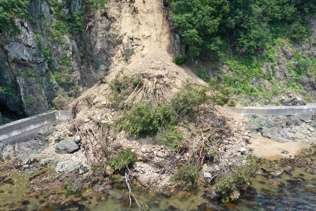
Predicting a landslide is less like a weather forecast and more like reading a map drawn with disappearing ink. The signals are rarely obvious. They vary according to the nature of the land, the slope and whether it has been raining for days or weeks. But if you know what to look for, the ground often screams before it starts to slip.
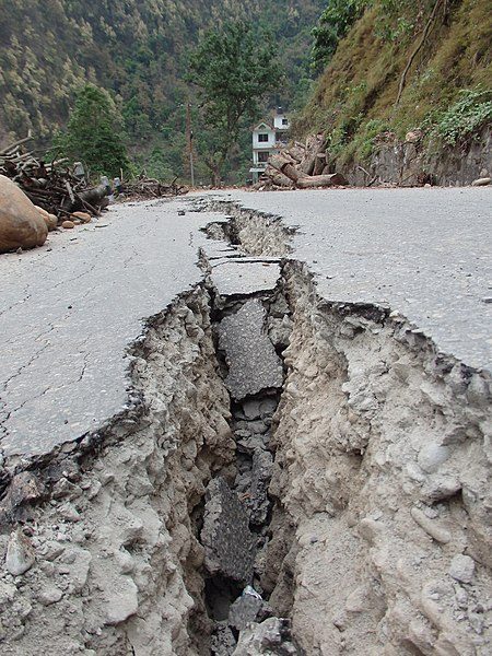
The most consistent red flag is cracking. When new cracks appear in the ground or old ones suddenly get bigger, the ground moves. It may not be visible to the naked eye – millimeters over weeks – but deep inside a failure surface is preparing to activate. These cracks often first appear in the infrastructure. The roads buckle. The foundation walls are cracking. These are not just structural failures; These are tension fractures that indicate that the entire underlying layer is being displaced.
This movement is rarely isolated. You may notice rocks or boulders falling in areas that have been stable for years. Seems like a coincidence. That’s not it. It’s the surface layer that peels away from what’s underneath.
Then there’s the floor itself. It doesn’t just break down; it changes shape. Look for subsidence, where the ground sinks inward and forms depressions. On the contrary, watch out for swelling. This often happens when clay layers hydrate. The water gets trapped, expands and pushes the surface upwards before the entire structure inevitably collapses.
It’s usually a slow process. But the time between “something is wrong” and “it happens” can be shockingly short. The ground is telling. The question is: are you listening?
Reading the Land: Vegetation and Water as Early Warnings
Nature often gives the alarm before the ground itself moves. Trees do not always fall straight down during a landslide. Sometimes they lean. If you see a forest where every pine is tilted in the same direction, down the slope, that is not wind. That is the soil creeping beneath them.
Water tells a similar story. A sudden spring appearing on a hillside where none existed before is a red flag. Muddy water flowing without recent rain? That means the ground is sliding and stirring up sediment deep below. Changes in stream flow or turbidity, unrelated to weather, signal shifting underground aquifers. Deep-seated landslides redirect subterranean water. It eventually bursts out on the surface.
Why Sensors and Sensors Alone Are Not Enough
Visual cues are vital. But they are not precise. You cannot guess the speed of a slide by squinting at a tree.
To know how the earth is moving, you need instruments. Inclinometers measure tilt. GPS stations track millimeter-scale shifts over time. Pressure sensors monitor pore water in the soil. These tools build a dataset. They turn guesses into hard numbers.
But there is a limit. You cannot put a sensor every square inch of a mountain range. The cost is too high. The terrain too rugged.
The Human Sensor Network
This is where the public matters. You cannot monitor every risky zone with technology. You must monitor it with people.
Awareness is the primary defense. Residents in at-risk areas are the first line of observation. They see the cracks. They hear the rumble. They notice the dry wells.
Early detection saves lives. It prevents material loss. But it requires more than gadgets. It requires a community that knows what to look for. When the ground shifts, the alert starts with the eyes on the ground.
The technology helps. The tools guide us. But in the end, it is about watching. And knowing when to move.