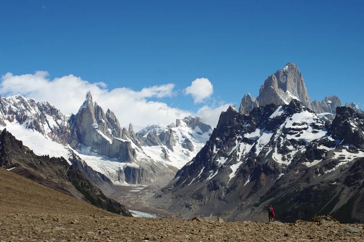
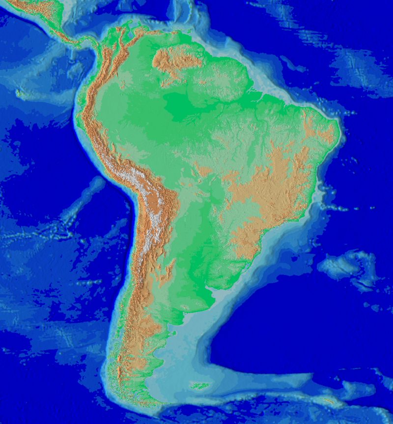
The Andes don’t just appear on maps. they define it. This mountain range stretches along the entire western edge of South America and is a geologically significant mountain. Its length is 8900 kilometers. This makes it the longest continental mountain range on the planet. It passes through seven countries. Venezuela. Colombia. Ecuador. Peru. Bolivia. Chile. Argentina.
The average height above sea level is about 4000 meters. The air is thinner at high altitudes. The landscape is divided into massive plateaus. Altiplano is the star here. It is the second highest plateau on the planet after the Tibetan Plateau.
However, this is where things get complicated. The Tibetan Plateau think of mountains. We are thinking of the Himalayas. We know how they are formed. Two large landmasses collided. They crashed into each other and push the Earth up. It was a straightforward, albeit violent, collision between continents.
The Andes tell a different story. Their rise is not the result of the collision of two continents. Geology is unique. The tectonic history that led to the uplift of the Andes is fundamentally different from the collision patterns seen in Asia. This distinction is important. It changes our understanding of the forces that shape our planet.

Why the Andes are rising
Look at the map. You can see that the Andes are not located between two continents. They are located between land and the Pacific Ocean. This place is located right on the Pacific Ring of Fire. This area is characterized by intense volcanic and seismic activity. All of this activity begins at a subduction zone. The Andes mountains in particular are the result of one specific tectonic process.
The Nazca oceanic plate is subducting under the South American continental plate. This is the subduction of the Nazca plate. When the heavy oceanic crust sinks into the Earth’s mantle, it creates enormous pressure. This pressure lifts the continental crust. The result is the highest mountain range in the Western Hemisphere. This is not the collision of two equal sized landmasses. It’s a relentless one-way descent that builds a mountain from the bottom up.
How diving works
This is not a gentle slide. The Nazca plate is moved to the east deep inside the earth. When it hits the South American plate, it cannot pass through it. I was depressed. Friction produces heat. The heat melts the rocks and forms magma. The magma rises. It feeds the volcanoes scattered throughout the region.
The earthquakes are just as significant. When the plates rub against each other, they stick together. The pressure rises. Then it snaps. The ground shook. That’s why this area is so dangerous. This is why mountains keep growing. Continents are compressed, folded and pushed upwards. Geological activity is strong and active. This is a process that has been going on for millions of years.
Real world impact
The importance of this tectonic structure is beyond the scope of geology textbooks. The minerals formed during this process are important. Copper, gold, silver and lithium deposits are all associated with this magmatic activity. The Andes are a treasure trove of natural resources. But creating wealth also comes with risks. Landslides are common. Flooding can occur on steep slopes after heavy rain.
This barrier also affects the region’s unique climate. The mountains block moisture from the Pacific Ocean. This leaves the Atacama desert on one side and dense forests on the other. Subduction zones determine where people can live. It determines where plants can be grown. This determines where the disaster will occur. Mountains are more than just rocks. It is a dynamic system that controls the landscape and people’s lives.
The Andes are not static monuments. They are a living record of tectonic movements.
The story continues deep into the earth’s crust. The heat is intense. The pressure is higher than you might imagine. How does rock behave in these conditions? It flows. It gets distorted. It changes.
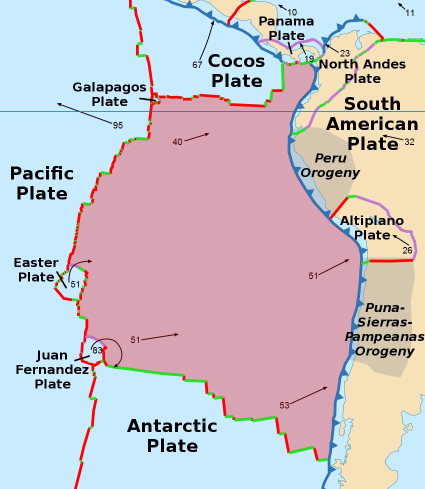

The Nazca discs are small. It is between the Pacific plate and the South American plate. You’ll be underwater in no time. The length of the year is about 3.7 cm. Speed is key.
The integration was not smooth. Subduction causes compression here. Especially along the western edge of the South American plate. This pressure supports the Andes.
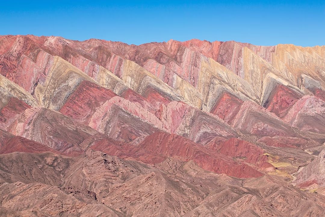
The forces caused by subduction crush the continental crust. The crust becomes thicker. The lock unit collapses. They are stacked on top of each other. The floor is actually raised up, which increases the range.
A hotplate that won’t fall
The building of the Andes began in earnest about 90 million years ago. Cretaceous. This process began in the Jurassic period. However, the Cretaceous period showed an acceleration. This resurrection is still going on.
Why has their rise been so violent? The main culprit is the Nazca disc itself. You are very young. It’s hot.
Ancient oceanic crust is dense. It easily sinks into the diaper. The young bark is buoyant. Withstands steep drops. He refuses to go too deep.
This buoyancy changes everything. The Nazca tablets remain almost horizontal. It is at the same height as the base of the South American plate. Friction spikes. The plates are locked together.
Think of it like sweeping a board under the rug. Press harder. The mat is non-slip. It freezes. Wrinkles accumulate. The carpet has become thick.
This is what happens to the upper crust. A horizontal slab blocks a subduction zone. This phenomenon is often called envy. Forces the top plate to undergo large deformations. Instead of sliding down, the ground pushed up.

The Earth’s Violent Response
The Earth’s crust doesn’t just stretch. It’s broken. When it breaks, the ground shakes. Countries sitting on the spine of the Cordillera knows The well. They respond to strong earthquakes as part of their territory. Some of these earthquakes are caused by subduction itself. Sometimes it happens because the mountain is still growing.
The subduction angle are dangerous. Produces the strongest vibration. Strong shaking often means a tsunami.
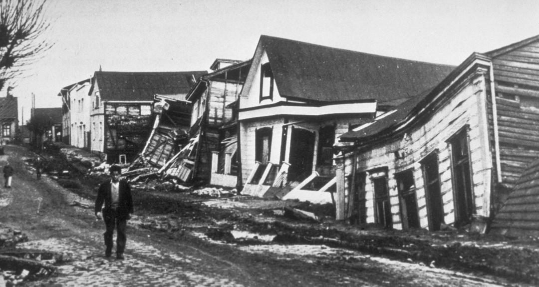
For proof of The, look no further than the Andes. The strongest earthquake in history happened there. On May 22, 1960, an earthquake occurred in Chile with a magnitude of 9.4-9.6. It took 10 minutes. The ocean responded immediately. The wave height is up to 25 meters. Thousands died. Valdivia was wiped out.
Why the Andes are important for earthquake safety
The Valdiviaa competition of 1960 is still the reference point. This shows what happens when tectonic plates grind against each other on a large scale. The subduction zone is locked. The pressure rises. When released, their energies are destructive.
This is more than just history. This is a warning. Communities in these areas need to understand the risks. Early warning systems can help. But the real defense is preparation. Earth is not interested in buildings. It works anyway.
“The 1960 Chile earthquake remains the most powerful earthquake ever recorded, showing that tectonic movements can change coastlines in minutes.”
Beyond the Andes: Other subduction zones
Not all subduction zones produce 9.6. But they all create risks. The Cascadia subduction zone in the Pacific Northwest is another example. It remained silent for centuries. The pressure rises. Scientists are worried about future large earthquakes.
The Japanese archipelago faces similar threats. The 2011 Tohoku earthquake and tsunami was a stark reminder of The. Subduction isn’t a one-time event. This is a cycle. One that repeats.
It is useful to understand these patterns. It doesn’t stop the shaking. But it can save lives. Building codes are important. Evacuation planning is important. Information is important.
The Human Cost of Tectonic Power
The 1960 earthquake killed thousands of people. It destroyed the city. It changed coastlines. Tsunamis travel across the Pacific Ocean. It reached Hawaii. It reached Japan.
This is the reality of living on the edge of the Earth’s crust. The land is alive. It moved. We’ll build on it anyway. We have to. But we must respect The power.
Future earthquakes are inevitable. The question is, how prepared are we? The data is clear. The stakes are high. The only variable is the human reaction.
What happens next?
The research continues. Seismologists track stress levels. They draw fault lines. They model potential scenarios. But the earth doesn’t follow models. It follows physics.
We can predict “when” with some degree of accuracy. We can’t predict the exact moment. This uncertainty is a challenge. It demands constant vigilance. It requires infrastructure investments. It requires a culture of preparation.
The mountains continue to rise. Earthquakes will continue. The only way forward is to adapt. Build smarter. Live with the risks. It’s not a denial. In awareness.
The

The Andean Volcanic Belt: A History of Explosive Power
The Andes are not just a geological backbone. These are the sites of some of the world’s most volatile volcanic activity. The region is defined by the Andean volcanic belt and is home to many active and highly dangerous mountains.
The northern landscape is dominated by Galeras, Nevado del Ruiz and Sangay. They are not sleeping giants. They were restless. When you walk to the center you will come across Cerro Panizos, Pastos Grandes, Guacha and La Pacana. These are not typical lava flow volcanoes. They are silicic. The lava here is very thick. Viscous. It doesn’t flow. This will hold the gas. This creates enormous pressure, causing an explosion that changes the landscape in minutes.
Then there is the south. During the last two decades, the area has been growing rapidly. Chaitén, Cordón Caulle and Calbuco have all recently erupted. But the connection between earthquakes and volcanoes is direct and strong here. Consider the 1960 Valdivia earthquake. This is the strongest record in history. It didn’t just shake the earth. This caused the Cordón Caulle volcano to erupt. The earth’s crust has changed. Release stress. The volcano answered.
Why is this important? Because the Andes remind us of how Earth’s systems are interconnected. One shock can change everything.